

12-Day South Island Itinerary (by Car or Campervan)

Planning a 12-day South Island itinerary can feel really overwhelming. There’s so much to see and do, and it can be hard to know what to include and what to save for next time.
Between glacier-carved landscapes, winding mountain passes, turquoise lakes, and some of the best hikes in New Zealand, there’s a lot competing for your attention.
One of the biggest mistakes I often see visitors make is trying to pack way too much into their itinerary. The thing is, you’ll need to be a bit strategic, or you might spend more time in the car than actually exploring the places you came all this way to see.
I don’t want that to be you, and I’m here to help. I live in Queenstown and have spent many years road tripping around the South Island on my weekends and holidays.
This is the exact route I’d share with friends and family looking for a 12-day South Island itinerary that includes a mix of iconic sights, beautiful day hikes, great local food, and towns worth spending time in. It works perfectly for either car or campervan travel.
So without further ado, here’s how to spend 12 days in the South Island!
FYI: This post may contain affiliate links, which means I may earn a small commission if you make a purchase (at no extra cost to you). I only share products & services I use, love & would recommend to a friend.
12 Day South Island Itinerary Overview
📍 Route: This is a road trip loop, starting and ending in Christchurch, but you can also tweak it to start in Queenstown instead.
Here’s an overview of the route:
Christchurch > West Coast > Wanaka > Fiordland National Park > Queenstown > Aoraki / Mount Cook National Park > Tekapo > Christchurch
🚙 Total distance: Approx. 2,105 km
⏱️ Pace: I consider this itinerary fast-paced but realistic. Most drive days are between 2-4 hours.
I’ve tried to minimise one-night stays so you’re not constantly packing up.
⭐️ Best for: First-time visitors who want to see the South Island’s highlights while enjoying easy to moderate day hikes.
🗓️ Best time of year: November through April is ideal for longer days and hiking conditions, but this itinerary works year-round.
I’ve included winter weather, driving, and hiking notes after the day-by-day guide.
Map of 12-Day South Island Itinerary
Where to hire a car or campervan for your road trip

🚙 Car hire: I use Discover Cars to compare prices on car rentals in New Zealand, and usually go with whoever has the best rates and good reviews. That said, I often go with Apex Rentals and highly recommend them!
🚐 Campervan hire: Motorhome Republic is my go-to resource for comparing prices on campervan rentals in New Zealand.
→ Tip: Here’s how to choose between renting a car or campervan in New Zealand
12-Day South Island Itinerary Day-by-Day
Day 1: Christchurch

Christchurch is the South Island’s largest city, with an international airport and abundance of car and campervan rentals. It makes an easy starting point for your road trip.
Before hitting the road, I recommend spending a day in Christchurch, particularly if you’ve just arrived from a long-haul flight. Shake off jet lag with some mellow walking around the city centre, which has been rebuilt following the 2010 and 2011 earthquakes and is a lovely place to explore.
What to do in Christchurch


- Enjoy breakfast and coffee at one of Christchurch’s fantastic cafes.
- Hop on the historic tram to sightsee while listening to helpful commentary from the driver. It’s a good way to get your bearings before exploring the city on your own.
- Stroll through the Christchurch Botanic Gardens, which are free to enjoy and are absolutely gorgeous.
- Visit the Riverside Market to browse the food stalls and enjoy lunch or a snack amidst the bustling atmosphere. Dmitri’s Souvlaki is my favourite place for lunch here.
- Walk along New Regent Street, Christchurch’s most charming street. The colourful pastel buildings house shops, cafes, and restaurants and it’s all very photogenic.
Related read: how to spend one day in Christchurch
Where to stay in Christchurch

- Budget ($) – Drifter
- Mid-range ($$) – West Fitzroy Apartments
- Luxury ($$$) – The Observatory Hotel
- Camping: The Tasman Holiday Park is the best option for camping in the city, but note that it’s about a 15-minute drive from here to the city centre.
Day 2: Punakaiki via Arthur’s Pass
🚗 Drive time from Christchurch to Punakaiki: 296 km / ~ 4 hours

It’s time to hit the road to start your South Island road trip!
Today, you’ll make your way over Arthur’s Pass to the wild West Coast.
Arthur’s Pass is one of the three main alpine passes in the South Island, traversing the Southern Alps to link the East Coast and the West Coast.
Along today’s drive, you’ll have some excellent opportunities for hiking and sightseeing. So, get an early start to make the most of the day.
Stops between Christchurch and Punakaiki


- Sheffield Pie Shop: Before ascending Arthur’s Pass, stop by this famous bakery to pick up a classic New Zealand road trip snack: the meat pie (or veggie pie!).
- Kura Tawhiti / Castle Hill: Go on a mellow walk here amongst impressive limestone rock formations.
- Devil’s Punchbowl Waterfall: Accessing this incredible waterfall takes a short but steep hike and quite a lot of stairs. It’s worth it, though—I rate this as one of the best waterfalls in the South Island!
- Otiri Viaduct Lookout: Stop at this roadside pull-out for awesome views over the Otira Viaduct, a large road bridge surrounded by alpine scenery. While here, you might also spot a kea, New Zealand’s mischievous alpine parrot.
- Greymouth: If you need groceries or a petrol top-up, stop in Greymouth; otherwise, you can skip this stop. There aren’t any supermarkets in Punakaiki, so this is the last stop for supplies.
What to do in Punakaiki


- Visit the Punakaiki Pancake Rocks and Blowholes. To see the blowholes in action, time your visit around high tide if possible!
- Hike the Pororari River Trail, which follows the tannin-stained Pororari River under a canopy of rainforest.
- Walk the Truman Track to Truman Beach to see a wispy waterfall drop onto the sand. The walk to get there is lovely, with the trail leading you through a gorgeous forest to the beach. If you want to access the beach, try to visit around low tide.
Where to stay in Punakaiki

- Budget ($) – Te Nikau Retreat
- Mid-range ($$) – Scenic Hotel Punakaiki
- Boutique stay ($$ – $$$) – Hydrangea Cottages
- Camping & cabins: Punakaiki Beach Camp
Day 3: Franz Josef
🚗 Drive time from Punakaiki to Franz Josef: 217 km / ~ 3 hours
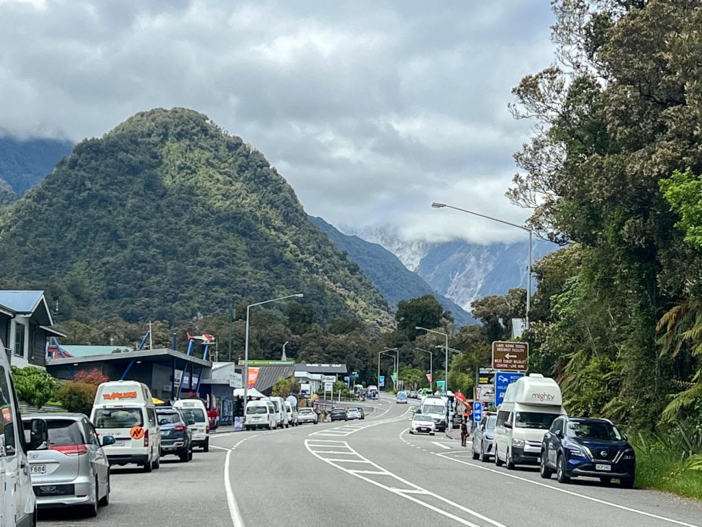
Make your way down the West Coast today to reach Glacier Country, home to Franz Josef Glacier and Fox Glacier.
As you drive down the coast, the scenery changes from the subtropical environment of Punakaiki to the rugged alpine beauty of the southern West Coast, where snow-covered mountains meet temperate forest.
One thing I should mention is that Glacier Country sees a lot of rain annually, so there’s a good chance it may rain during your visit. My best suggestion is to pack a good raincoat, and you’ll still be able to explore even if it’s a bit drizzly outside.
Stops on the drive from Punakaiki to Franz Josef


- Hokitika: This cute seaside town is a good spot to stop for some food. The Hokitika Sandwich Co is always a must-visit for me! If you need any groceries or a fuel top-up, there’s a New World supermarket here and multiple petrol stations. I’d stock up on groceries here instead of waiting for Franz Josef, where there’s only a small Four Square market.
- Hokitika Gorge: Detour here for a gorgeous, easy walk to see a stunning, electric-blue river gorge surrounded by pale limestone cliffs. It’s absolutely beautiful and worth the journey!
Related read: the best stops on the drive from Christchurch to Franz Josef
What to do in Franz Josef

- Walk to the Franz Josef Glacier lookout to see Franz Josef glacier from afar.
- Soak in the Waiho Hot Tubs.
- If you’re keen to splash out, book a helicopter tour to see the glacier up close. You might want to add an extra day in Franz Josef if you plan to do this, just in case bad weather ruins your plans.
Where to stay in Franz Josef

- Budget ($) – Wild Kea Lodge
- Mid-range ($$) – Aspen Court Franz Josef
- Luxury ($$$) – Legacy Te Waonui Hotel
- Camping: Orange Sheep Campervan Park or Rainforest Retreat
Days 4 & 5: Wanaka
🚗 Drive time from Franz Josef to Wanaka: 284 km / ~ 4 hours 10 minutes

The drive from Franz Josef to Wanaka takes you across Haast Pass, a waterfall-lined alpine pass with numerous scenic stops along the way.
While Google Maps might say that it takes 4 hours to do this drive, you’ll want to allow much more time than that—honestly, a full day if possible! Get an early start and plan for lots of stops.
I’d also pack a lunch for today’s drive, because there aren’t many good stops for food along the way.
Stops between Franz Josef & Wanaka


- Lake Matheson: A short detour from Fox Glacier leads you to the trailhead for this gentle hike. You’ll walk through the forest to reach picturesque Lake Matheson—on a clear, calm day, the lake reflects the surrounding landscape like a mirror.
- Ship Creek: Stop here for your last chance to see the Tasman Sea before heading inland. You might even get lucky enough to spot Hector’s dolphins in the water here!
- Haast Pass Waterfalls: There are several beautiful waterfalls along Haast Pass, each requiring just a short, easy walk to reach. Roaring Billy Falls, Thunder Creek Falls, and Fantail Falls are all worth a visit.
- The Blue Pools: Go on an easy hike through the bush and across suspension bridges to see the famous Blue Pools, which are fed by glacial waters and are so blue, they look unreal.
What to do in Wanaka


- Walk the lakefront to the Wanaka Tree: The famous Wanaka Tree is a bit overrated if you ask me, but it’s still worth seeing. The highlight for me, though, is the walk to get there—walk from town along the lakefront path and then continue walking past the tree. Walk as far as Waterfall Creek, or simply turn back whenever you get tired.
- Go hiking: Wanaka is a hiker’s paradise. My favourite Wanaka trail is the Rob Roy Glacier Track. Other popular options are Roy’s Peak, the Rocky Mountain Track, and Mount Iron. For something mellow, walk a section of the peaceful Upper Clutha River Track.
- Enjoy Wanaka’s awesome food: Go to Scroggin for breakfast, the Big Fig for delicious veggie-packed bowls, and the Brownston Street Food Trucks for a fantastic assortment of casual eateries (Burrito Craft is my go-to!).
- Sample craft beer: If you’re a craft beer lover like me, you’ll want to visit one of Wanaka’s excellent breweries. B.effect, Rhyme x Reason, and Ground Up are all great.
- Visit the Wanaka Lavender Farm: For a relaxing activity, head to the Wanaka Lavender Farm to see their gorgeous gardens and cute farm animals.
Where to stay in Wanaka

- Budget ($) – a cabin at the Hampshire Holiday Park Wanaka
- Mid-range ($$) – Clearbrook Motel
- Luxury ($$$) – Lakeside Apartments Wanaka
- Camping in Wanaka: Hampshire Holiday Park Wanaka
Days 6 & 7: Te Anau & Milford Sound
🚗 Drive time from Wanaka to Te Anau: 227 km / ~ 3 hours

Today, you’ll drive from Wanaka to Te Anau, the gateway to Fiordland National Park and Milford Sound.
You’ll drive right past Queenstown today, but don’t worry—you’ll return in a couple of days to enjoy it properly.
I recommend staying in Te Anau for two nights, with a day trip to Milford Sound on Day 7 of this itinerary. Te Anau has way more accommodation on offer, and far fewer sandflies than Milford Sound.
Alternatively, if you’re campervanning, you could split this up with one night in Te Anau and one at a campground close to Milford Sound.
Stops on the drive from Wanaka to Te Anau


- Cardrona: This small settlement is home to the historic Cardrona Hotel, a popular photography spot. The Cardrona Hall is also very cute and not nearly as well-known or busy as the hotel.
- Crown Range Road: New Zealand’s highest main road links Wanaka to Queenstown, and offers stellar views over the Remarkables and Wakatipu Basin.
- Note: some campervan companies prohibit driving their vans over the Crown Range Road; in that case, you can take the slightly longer route via Cromwell and State Highway 6.
- Note: some campervan companies prohibit driving their vans over the Crown Range Road; in that case, you can take the slightly longer route via Cromwell and State Highway 6.
- Devil’s Staircase: After passing by Queenstown, you’ll take the winding Devil’s Staircase road along Lake Wakatipu. There’s a good pull-out area on the right-hand side of the road if you want to stop to enjoy the view, but it’s easier to access on the return drive from Te Anau to Queenstown.
- Garston: Stop here for a coffee at the Coffee Bomb and pick up some local honey from the Garston Hunny Shop. Try the local wild thyme honey—it’s delicious!
What to do in Te Anau & Milford Sound


- Go hiking around Te Anau—some excellent options are the Control Gates to Brod Bay, or Rainbow Reach to Shallow Bay.
- Take a cruise to see the Te Anau Glow Worm Caves.
- Enjoy a meal in Te Anau at Sandfly Cafe, Ditto, and/or Redcliff Cafe.
- Day trip to Milford Sound. The drive from Te Anau to Milford Sound is packed with hikes and scenic lookouts, so plan for a full day of sightseeing! Once you reach Milford Sound, you can hop on a scenic cruise (make sure to prebook!). And if you’re up for a hike, the Key Summit Track is a great option.
Where to stay in Te Anau

- Budget ($) – a cabin at the Tasman Holiday Park
- Mid-range ($$) – Lakefront Lodge
- Luxury ($$$) – Fiordland Lakeview Motel & Apartments
- Camping: Tasman Holiday Park or Te Anau Lakeview Holiday Park (or see the best campsites in Te Anau & Milford Sound)
Further reading: where to stay near Milford Sound
Days 8 & 9: Queenstown
🚗 Drive time from Te Anau to Queenstown: 171 km / ~ 2 hours 15 minutes

Queenstown tops the “must-see” lists for most South Island visitors. This gorgeous town is cradled by mountains and sits along the shores of Lake Wakatipu.
While it’s known as the “Adventure Capital of the World” because of its attractions like bungy jumping and skydiving, there’s a lot more to Queenstown than adrenaline-rushing activities.
Around Queenstown, you can hike on scenic trails, sip local wines, enjoy fantastic food, explore the nearby towns of Arrowtown and Glenorchy, and so much more.
I live in Queenstown and love it here so much. It can feel pretty busy in the town centre, but if you’re keen to escape the crowds, all you need to do is get out into nature nearby.
Here are some of my favourite things to do in Queenstown!
What to do in Queenstown


- Go hiking. Some of my favourite local trails include Queenstown Hill, the Moke Lake Loop Track, Bob’s Cove, and the Mt Crichton Loop Track.
- Wander around the Queenstown Gardens and the lovely peninsula trail surrounding the gardens. It’s easily one of the best free things to do in Queenstown!
- Day trip to Glenorchy. The drive from Queenstown to Glenorchy is one of the most scenic roads in New Zealand. You can also continue on past Glenorchy to reach Mount Aspiring National Park, where you can do a day hike on the Routeburn Track or Lake Sylvan.
- Visit Arrowtown, a charming historic gold mining town that feels like something out of a Hallmark movie. The drive from Queenstown to Arrowtown takes only 20 minutes, or you can take the public Orbus bus there for just a few dollars.
- Ride the Skyline Gondola to Bob’s Peak to get incredible views over Lake Wakatipu, the Remarkables, and town. The luge at the top is a lot of fun, too!
- Hop on the historic TSS Earnslaw steamship and cruise across Lake Wakatipu to reach Walter Peak Station, where you can enjoy a fantastic BBQ lunch or dinner.
- Go wine tasting in the nearby Gibbston wine region. I recommend Mt Rosa and Kinross. The Hop on, Hop off wine bus makes it easy to get around to the wineries.
- Enjoy Queenstown’s delicious food and drinks. Fergburger is the most famous eatery in town, but be prepared to queue. There are too many places to name here, but some of my favourite spots are Sundays for woodfired pizzas, the Boat Shed Cafe for brunch, and Altitude Brewing for burgers and craft beer. If you want more recommendations, just ask me! (I need to write a “where to eat in Queenstown” guide soon…).
Where to stay in Queenstown

- Budget ($) – Tahuna Pod Hostel
- Mid-range ($$) – Garden Court Suites & Apartments
- Luxury ($$$) – Stay of Queenstown
- Camping: the best campsites in Queenstown
Day 10: Aoraki / Mount Cook National Park
🚗 Drive time from Queenstown to Aoraki / Mount Cook National Park: 263 km / ~ 3.5 hours

Today you’ll start heading north to eventually loop back to Christchurch. Luckily, though, there are still some incredible places to see—like Aoraki / Mount Cook National Park!
Mount Cook National Park is one of my favourite destinations in the South Island, hands down. And I’m not the only one who feels this way. Whenever I ask visitors about where they’ve loved most on their New Zealand trip, they almost always say “Mount Cook!”—it’s that good.
Hikers and outdoor lovers will be in paradise here; the national park is home to some of the best hikes in the South Island. And the drive to get to Mount Cook is absolutely stunning, too.
So, get excited for yet another epic day on your 12 day South Island itinerary!
Stops on the drive from Queenstown to Mount Cook National Park


- Lindis Pass: You’ll drive over this beautiful alpine pass to get from the Otago Region to the Mackenzie Basin. The road is lined with golden tussock grasses—and snow in winter—and is very picturesque. There’s a scenic lookout at the summit where you can pull over to snap some photos.
- Omarama Clay Cliffs: It’s worth the short detour to visit the Omarama Clay Cliffs, where you can walk beneath towering hoodoo-like rock formations.
- Omarama Hot Tubs: For a relaxing activity along today’s drive, consider booking one of these woodfired hot tubs, which are filled with fresh mountain water and have lovely views of the surrounding countryside.
- Twizel: If you need a grocery or fuel top-up, Twizel is the last place to do so before heading into Mount Cook National Park. If you’re in town around lunchtime, Mint Folk and Co is a fantastic spot for a meal.
- Lake Pukaki: Soon after leaving Twizel, you’ll reach the shores of turquoise-blue Lake Pukaki. The colour of the water is unreal and you’ll get great views of it as you drive towards the national park. Pull over at Peter’s Lookout for a great view of the lake and—on a clear day—Aoraki / Mount Cook itself in the distance.
What to do in Mount Cook National Park


Besides simply admiring the epic scenery, the best thing to do in Mount Cook National Park is to go hiking.
There’s a great variety of hiking trails within the national park, ranging from mellow to challenging. You don’t have to lug yourself up a mountain to enjoy the trail scenery here, unless, of course, you want to!
Here are my favourite hikes in Mount Cook National Park:
- Hooker Valley Track (~10 km return / easy-moderate) – this is one of the most popular day hikes in the South Island, leading you across swingbridges along a gentle trail to reach incredible views over a glacial lake and Aoraki / Mount Cook.
- Kea Point Track (~2 km return / easy) – a mellow walk takes you to a stunning viewpoint over Mueller Glacier Lake with views of Aoraki / Mount Cook on a clear day.
- Sealy Tarns Track (~5 km return / hard) – this trail climbs up over 2,000 steps to reach an epic viewpoint over the national park, with tarns reflecting the surrounding mountains. This is a lung-busting hike but it’s well worth the effort if you’re up for a workout.
- Tasman Glacier View Lookout (2 km return / easy-moderate) – a short but fairly steep trail climbs to a view over the glacial Tasman Lake, with a view of the receding Tasman Glacier in the distance. In summer, you can often see icebergs floating in the lake.
Where to stay in Mount Cook National Park

- Budget ($) – Haka House Aoraki Mount Cook
- Mid-range ($$) – Aoraki Court Motel
- Luxury ($$$) – The Hermitage Hotel
- Camping: White Horse Hill DOC Campsite (or see the best campsites around Mount Cook National Park)
Further reading: where to stay near Mount Cook National Park
Day 11: Lake Tekapo
🚗 Drive time from Aoraki / Mount Cook National Park to Lake Tekapo: 104 km / ~ 1 hour 15 minutes

On the last full day of your 12-day South Island itinerary, I recommend lingering a while in Mount Cook National Park.
You only have a short drive today, which gives you ample time to keep enjoying the alpine scenery around Mount Cook.
Once you’ve tackled all of the hiking trails on your wishlist, it’s time to hit the road towards Lake Tekapo.
Stops on the drive from Mount Cook to Lake Tekapo

- Mt Cook Alpine Salmon Shop: stop here for fresh sashimi made from salmon raised in the glacial waters around Lake Pukaki. The views from the outdoor dining area are stellar.
- Pukaki Kettle Hole Track: If you’re keen for more hiking, try the Pukaki Kettle Hole Track, which I think is a massively underrated hike. A mellow one hour loop takes you around a kettle hole formed by the retreating Tasman Glacier many years ago. On a clear day, you’ll get awesome views across Lake Pukaki and Mount Cook.
What to do at Lake Tekapo


- Walk across the beautiful footbridge down to the Lake Tekapo waterfront and see the famous Church of the Good Shepherd, a popular photography subject.
- If your visit coincides with late spring or early summer, you’ll be able to see the swathes of wild lupins that grow along the shores of Lake Tekapo.
- Hike or drive up to the Mount John Summit for sweeping views over Lake Tekapo. Getting a coffee and cake from Astro Cafe here is never a bad idea, either! The walk is free, but if you choose to drive, there’s a road user fee per vehicle ($15 at the time of writing this).
- Soak in the Tekapo Springs hot pools while enjoying great views over the lake.
- Go stargazing after dark—Tekapo is part of a Dark Sky Reserve, and on a clear night, you’re almost guaranteed to see heaps of stars!
Where to stay in Lake Tekapo

- Budget ($) – Haka House Lake Tekapo
- Mid-range ($$) – Mackenzie Suites
- Luxury ($$$) – Galaxy Boutique Hotel
- Camping: Lake’s Edge Holiday Park
Day 12: Christchurch
🚗 Drive time from Lake Tekapo to Christchurch: 226 km / ~ 3 hours

It’s time to say goodbye to the South Island today and make your way back to Christchurch for departure.
The drive from Tekapo to Christchurch is straightforward and easy, and takes about 3 hours without stops. I’d give yourself plenty of time to get to the airport (ideally, you’ll have booked a late afternoon or early evening flight out of Christchurch).
If there’s one stop I recommend making on today’s drive, it’s Fairlie Bakehouse for one of their legendary pies, which are arguably the best in New Zealand (they get my vote!). There’s no better way to end a South Island road trip if you ask me.
Best time of year for this 12 day South Island itinerary
You can do this trip year-round, but November through early April will usually be best for hiking and longer daylight hours.
Here’s what to expect season by season.
Spring (September, October, November)

Spring is a gorgeous time to visit the South Island, with the mountains capped in snow, baby lambs frolicking about, and waterfalls at their best.
However, the weather can be fickle in spring, so expect some rainy and windy days. It’s also possible for it to snow in early spring, so keep an eye on the weather report and road conditions.
If you’re keen to go skiing, September and early-to-mid October offer great spring skiing conditions in Queenstown and Wanaka. And if you’d like to see lupins in the South Island, they typically start blooming in late November.
Summer (December, January, February)

Summer is peak season in the South Island, so it’s our busiest time of year.
It’s a great time of year for hiking, swimming, and campervanning, but make sure to book everything in advance so you don’t miss out.
In particular, the two weeks just after Christmas are the absolute peak travel season, as this is when many Kiwis take their annual break. If you’re planning to go camping, just know that the campgrounds will be very busy during this time and you should book your campsites in advance.
February is one of my favourite months for travelling around the South Island, as the weather is usually settled and the crowds start to thin after the mad rush of late December and January.
Autumn (March, April, May)

Autumn is a fantastic time of year for this road trip, and for visiting the South Island in general. The weather is often fantastic in March and April (although you should still pack a raincoat!) and it’s far less crowded than summer.
From late March through April, autumn colours add a gorgeous pop of colour to the landscapes around Central Otago and parts of the Mackenzie Region.
If I had to pick an absolute favourite month for this road trip, it would be March!
Winter (June, July, August)
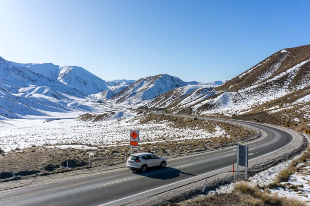
Winter brings snow to the South Island’s mountains, which looks incredibly picturesque. However, you do need to take care if you plan to travel in winter, because the roads can be icy and snowy.
If you do this road trip in winter, I suggest driving between 10 am and 5 pm to avoid black ice (basically, avoid driving in the dark or early hours of the morning). It’s also important to carry chains in your vehicle and keep an eye on the weather and road reports.
You may need to be flexible with your plans if roads close; for example, the Crown Range Road, Lindis Pass, and the Milford Highway can close if conditions are unsafe.
Some of the hikes mentioned in this article won’t be doable in winter unless you’re an experienced winter hiker, but there are plenty of low elevation trails you can still do.
Thanks for reading my 12 day South Island itinerary!

I truly hope this has helped you plan a fantastic trip around this special part of the South Island.
As always, if you have any questions or feedback for me, please leave a comment below. I really love hearing from you, and am always happy to help you tweak my itineraries to fit your own trip!
